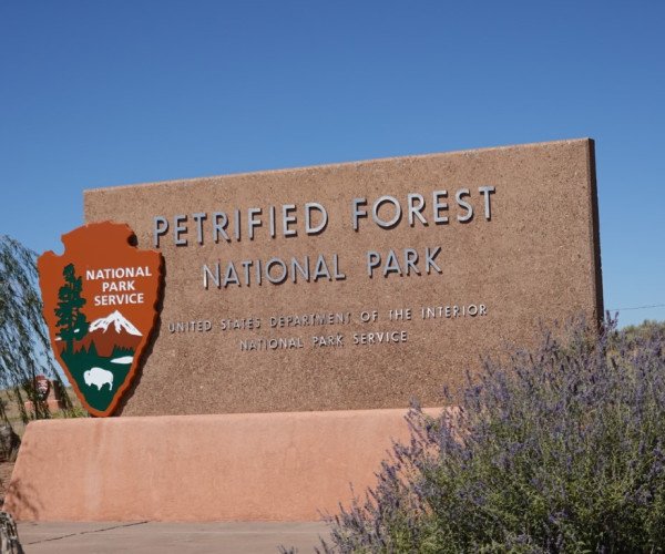
Petrified Forest National Park is a national park of the United States in Navajo and Apache counties in northeastern Arizona. Named for its large deposits of petrified wood, the park covers about 346 square miles (900 square kilometers), encompassing semi-desert shrub steppe as well as highly eroded and colorful badlands. The park's headquarters is about 26 miles (42 km) east of Holbrook along Interstate 40 (I-40), which parallels the BNSF Railway's Southern Transcon, the Puerco River, and historic U.S. Route 66, all crossing the park roughly east–west. The site, the northern part of which extends into the Painted Desert, was declared a national monument in 1906 and a national park in 1962. The park received 644,922 recreational visitors in 2018. Averaging about 5,400 feet (1,600 m) in elevation, the park has a dry windy climate with temperatures that vary from summer highs of about 100 °F (38 °C) to winter lows well below freezing. More than 400 species of plants, dominated by grasses such as bunchgrass, blue grama, and sacaton, are found in the park. Fauna include larger animals such as pronghorns, coyotes, and bobcats; many smaller animals, such as deer mice, snakes, lizards, and seven kinds of amphibians; and more than 200 species of birds, some of which are permanent residents and many of which are migratory. About one third of the park is designated wilderness—50,260 acres (79 sq mi; 203 km2).[7] The Petrified Forest is known for its fossils, especially fallen trees that lived in the Late Triassic Epoch, about 225 million years ago. The sediments containing the fossil logs are part of the widespread and colorful Chinle Formation, from which the Painted Desert gets its name. Beginning about 60 million years ago, the Colorado Plateau, of which the park is part, was pushed upward by tectonic forces and exposed to increased erosion. All of the park's rock layers above the Chinle, except geologically recent ones found in parts of the park, have been removed by wind and water. In addition to petrified logs, fossils found in the park have included Late Triassic ferns, cycads, ginkgoes, and many other plants as well as fauna including giant reptiles called phytosaurs, large amphibians, and early dinosaurs. Paleontologists have been unearthing and studying the park's fossils since the early 20th century. The park's earliest human inhabitants arrived 13,000 years ago.[8] These Clovis-era people are the ancestors of Native Americans.[9][10] By about 2,500 years ago Ancestral Pueblo farmers were growing corn and living in subterranean pit houses in what would become the park.[11] By one-thousand years ago Ancestral Pueblo farmers lived in above-ground, masonry dwellings called pueblos and gathered in large communal buildings called great kivas.[12] By 1450 CE Ancestral Pueblo farmers in the Petrified Forest migrated to join rapidly growing communities on the Hopi Mesas to the northwest and the Pueblo of Zuni to the east–these locations are still home to thousands of descendant community members today.[13] More than 1,000 archeological sites, including petroglyphs, have been discovered in the park. These ancestral places remain important to descendant communities. In the 16th century, Spanish explorers visited the area, and by the mid-19th century a U.S. team had surveyed an east–west route through the area where the park is now located and noted the petrified wood.[14] Later, roads and a railway followed similar routes and gave rise to tourism and, before the park was protected, to large-scale removal of fossils. Theft of petrified wood remains a problem in the 21st century.
163 Photos
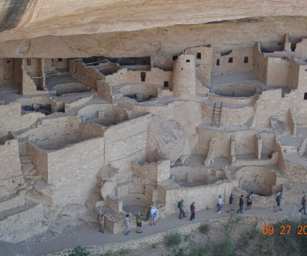
Mesa Verde National Park is a national park of the United States and UNESCO World Heritage Site located in Montezuma County, Colorado, and the only World Heritage Site in Colorado. The park protects some of the best-preserved Ancestral Puebloan ancestral sites in the United States. Established by Congress and President Theodore Roosevelt in 1906, the park occupies 52,485 acres (212 km2) near the Four Corners region of the American Southwest. With more than 5,000 sites, including 600 cliff dwellings,[2] it is the largest archaeological preserve in the United States.[3] Mesa Verde (Spanish for "green table", or more specifically "green table mountain") is best known for structures such as Cliff Palace, one of the largest cliff dwellings in North America. Starting c. 7500 BC Mesa Verde was seasonally inhabited by a group of nomadic Paleo-Indians known as the Foothills Mountain Complex. The variety of projectile points found in the region indicates they were influenced by surrounding areas, including the Great Basin, the San Juan Basin, and the Rio Grande Valley. Later, Archaic people established semi-permanent rock shelters in and around the mesa. By 1000 BC, the Basketmaker culture emerged from the local Archaic population, and by 750 AD the Ancestral Puebloans had developed from the Basketmaker culture. The Pueblo people survived using a combination of hunting, gathering, and subsistence farming of crops such as corn, beans, and squash (the "Three Sisters"). They built the mesa's first pueblos sometime after 650, and by the end of the 12th century, they began to construct the massive cliff dwellings for which the park is best known. By 1285, following a period of social and environmental instability driven by a series of severe and prolonged droughts, they migrated south to locations in Arizona and New Mexico, including the Rio Chama, the Albuquerque Basin, the Pajarito Plateau, and the foot of the Sangre de Cristo Mountains.
98 Photos
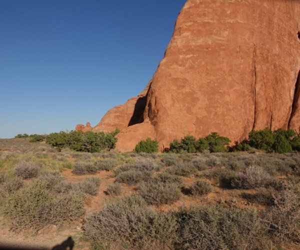
Arches National Park is a national park of the United States in eastern Utah. The park is adjacent to the Colorado River, 4 mi (6 km) north of Moab, Utah. The park contains more than 2,000 natural sandstone arches, including the well-known Delicate Arch, which constitute the highest density of natural arches in the world. It also contains a variety of other unique geological resources and formations.[3][4] The national park lies above an underground evaporite layer or salt bed, which is the main cause of the formation of the arches, spires, balanced rocks, sandstone fins, and eroded monoliths in the area. The park consists of 310.31 km2 (76,680 acres; 119.81 sq mi; 31,031 ha) of high desert located on the Colorado Plateau.[5] The highest elevation in the park is 5,653 ft (1,723 m) at Elephant Butte, and the lowest elevation is 4,085 ft (1,245 m) at the visitor center. The park receives an average of less than 10 in (250 mm) of rain annually. Administered by the National Park Service, the area was originally named a national monument on April 12, 1929, and was redesignated as a national park on November 12, 1971
85 Photos
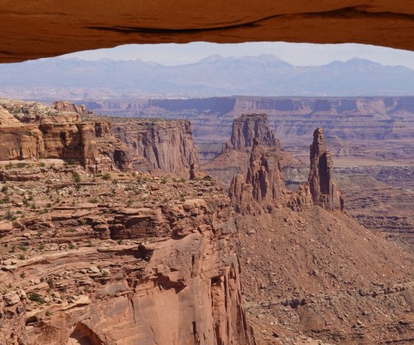
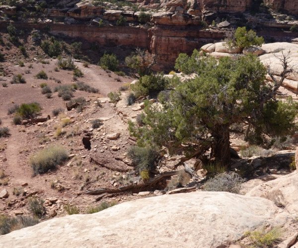
The Needles forms the southeast corner of Canyonlands and was named for the colorful spires of Cedar Mesa Sandstone that dominate the area. The Needles are tower-like hills of Cedar Mesa sandstone cut down and carved by the Green and Colorado Rivers over 20 million years ago. Water erosion caused by the flowing streams and heavy rains slowly shaped the geological features we admire today.
118 Photos
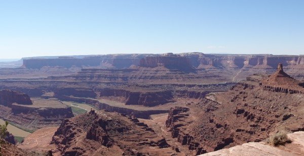
Dead Horse Point State Park is a state park in San Juan County, Utah in the United States, featuring a dramatic overlook of the Colorado River and Canyonlands National Park.[4] The park opened to the public in 1959 and covers 5,362 acres (2,170 ha) of high desert at an altitude of 5,900 feet (1,800 m)
84 Photos
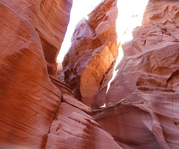
Located near Page, Arizona,Antelope Canyon X is a slot canyon in Antelope Canyon accessible only through Taadidiin Tours. In the 1860s, Hastiin Tadidinii, avoided the Long Walk by hiding in the same slot canyons guests now tour. His son, Clyde Tadytin, founded a permanent homestead in the area, which was the northwesternmost part of the Navajo Nation.
147 Photos
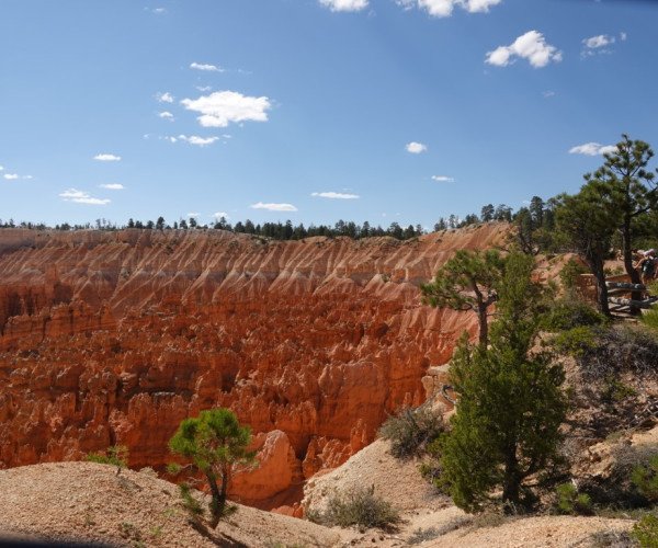
Bryce Canyon National Park (/braɪs/) is a national park of the United States located in southwestern Utah. The major feature of the park is Bryce Canyon, which despite its name, is not a canyon, but a collection of giant natural amphitheaters along the eastern side of the Paunsaugunt Plateau. Bryce is distinctive due to geological structures called hoodoos, formed by frost weathering and stream erosion of the river and lake bed sedimentary rock. The red, orange, and white colors of the rocks provide spectacular views for park visitors. Bryce Canyon National Park is much smaller and sits at a much higher elevation than nearby Zion National Park. The rim at Bryce varies from 8,000 to 9,000 feet (2,400 to 2,700 m). The area is in portions of Garfield County[3] and Kane County.[4] The Bryce Canyon area was settled by Mormon pioneers in the 1850s and was named after Ebenezer Bryce, who homesteaded in the area in 1874.[5] The area was originally designated as a national monument by President Warren G. Harding in 1923 and was redesignated as a national park by Congress in 1928. The park covers 35,835 acres (55.992 sq mi; 14,502 ha; 145.02 km2)[1] and receives substantially fewer visitors than Zion National Park (nearly 4.3 million in 2016) or Grand Canyon National Park (almost 6 million in 2016), largely due to Bryce's more remote location. In 2023, Bryce Canyon received 2,461,269
83 Photos
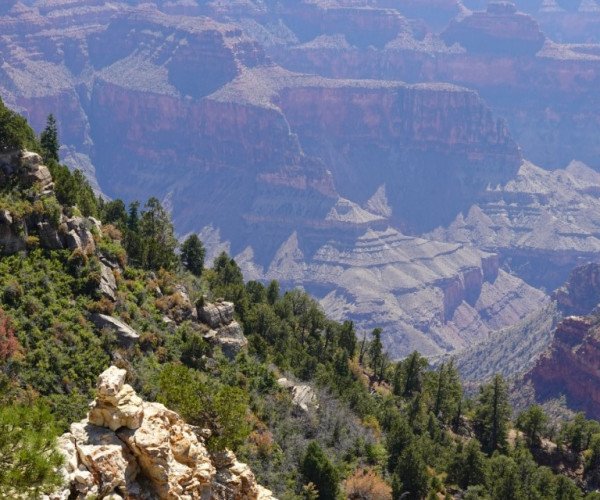
The Grand Canyon[a] is a steep-sided canyon carved by the Colorado River in Arizona, United States. The Grand Canyon is 277 miles (446 km) long, up to 18 miles (29 km) wide and attains a depth of over a mile (6,093 feet or 1,857 meters).[6]: 902 The canyon and adjacent rim are contained within Grand Canyon National Park, the Kaibab National Forest, Grand Canyon–Parashant National Monument, the Hualapai Indian Reservation, the Havasupai Indian Reservation and the Navajo Nation. The surrounding area is contained within the Baaj Nwaavjo I'tah Kukveni – Ancestral Footprints of the Grand Canyon National Monument. President Theodore Roosevelt was a major proponent of the preservation of the Grand Canyon area and visited it on numerous occasions to hunt and enjoy the scenery. Nearly two billion years of Earth's geological history have been exposed as the Colorado River and its tributaries cut their channels through layer after layer of rock while the Colorado Plateau was uplifted.[7][8] While some aspects about the history of incision of the canyon are debated by geologists,[7][9] several recent studies support the hypothesis that the Colorado River established its course through the area about 5 to 6 million years ago.[7][1][10][11] Since that time, the Colorado River has driven the down-cutting of the tributaries and retreat of the cliffs, simultaneously deepening and widening the canyon. For thousands of years, the area has been continuously inhabited by Native Americans, who built settlements within the canyon and its many caves. The Pueblo people considered the Grand Canyon a holy site, and made pilgrimages to it.[12] The first European known to have viewed the Grand Canyon was García López de Cárdenas from Spain, who arrived in 1540.
88 Photos
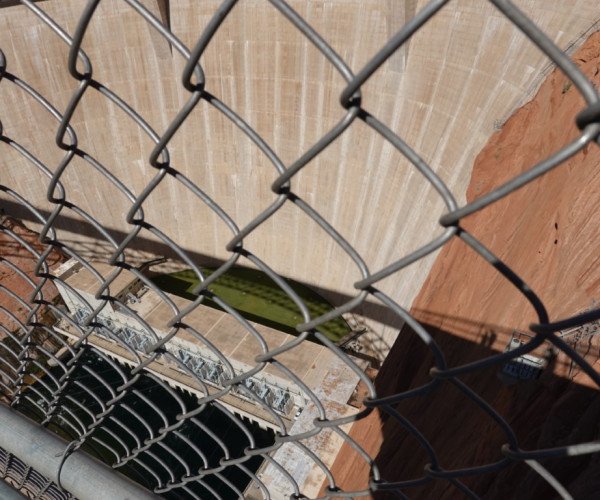
Glen Canyon Dam is a concrete arch-gravity dam in the southwestern United States, located on the Colorado River in northern Arizona, near the city of Page. The 710-foot-high (220 m) dam was built by the Bureau of Reclamation (USBR) from 1956 to 1966 and forms Lake Powell, one of the largest man-made reservoirs in the U.S. with a capacity of more than 25 million acre-feet (31 km3).[4] The dam is named for Glen Canyon, a series of deep sandstone gorges now flooded by the reservoir; Lake Powell is named for John Wesley Powell, who in 1869 led the first expedition to traverse the Colorado River's Grand Canyon by boat. A dam in Glen Canyon was studied as early as 1924, but these plans were initially dropped in favor of the Hoover Dam (completed in 1936) which was located in the Black Canyon. By the 1950s, due to rapid population growth in the seven U.S. and two Mexican states comprising the Colorado River Basin, the Bureau of Reclamation deemed the construction of additional reservoirs necessary.[8] The Glen Canyon Dam remains a central issue for modern environmentalist movements. Beginning in the late 1990s, the Sierra Club and other organizations renewed the call to dismantle the dam and drain Lake Powell in Lower Glen Canyon. Glen Canyon and Lake Powell are managed by the Department of the Interior within Glen Canyon National Recreation Area. Since first filling to capacity in 1980, Lake Powell water levels have fluctuated greatly depending on water demand and annual runoff. The operation of Glen Canyon Dam helps ensure an equitable distribution of water between the states of the Upper Colorado River Basin (Colorado, Wyoming, and most of New Mexico and Utah) and the Lower Basin (California, Nevada and most of Arizona).[8] During years of drought, Glen Canyon guarantees a water delivery to the Lower Basin states, without the need for rationing in the Upper Basin. In wet years, it captures extra runoff for future use.[8] The dam is also a major source of hydroelectricity, averaging over 4 billion kilowatt hours per year.[7] The long and winding Lake Powell, known for its scenic beauty and recreational opportunities including houseboating, fishing and water skiing, attracts millions of tourists each year to the Glen Canyon National Recreation Area.[9] In addition to its flooding of the scenic Glen Canyon, the dam's economic justification was questioned by some critics.[10] It became "a catalyst for the modern environmental movement,"[11] and was one of the last dams of its size to be built in the United States.[12] The dam has been criticized for the large evaporative losses from Lake Powell and its impact on the ecology of the Grand Canyon, which lies downstream; environmental groups continue to advocate for the dam's removal. Water managers and utilities state that the dam is a major source of renewable energy and provides a buffer for severe droughts.
19 Photos
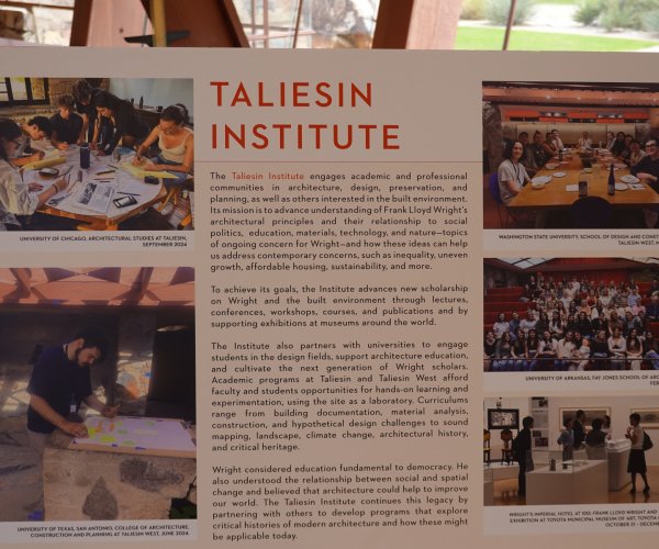
Taliesin West (/ˌtæliːˈɛsɪn/ tal-ee-ESS-in[3][4]) is a studio and home developed by the American architect Frank Lloyd Wright in Scottsdale, Arizona, United States. Named after Wright's Taliesin studio in Spring Green, Wisconsin, Taliesin West was Wright's winter home and studio from 1937 until his death in 1959. The complex is the headquarters of the Frank Lloyd Wright Foundation, a nonprofit organization, which hosts tours and events there. Taliesin West is designated as a National Historic Landmark and a World Heritage Site. Wright and his Taliesin Fellowship (later the School of Architecture) began making wintertime pilgrimages from Wisconsin to Arizona in 1935, and he bought a site in the McDowell Mountains two years later. His apprentices set up a temporary camp there, erecting the initial structures between 1938 and 1941. During Wright's lifetime, he oversaw several expansions, and some of the original construction materials were replaced. After Wright's death, the fellowship continued to modify the structures, and Taliesin West gradually gained popularity as a tourist attraction. The Frank Lloyd Wright Foundation began planning major renovations and a visitor center in the late 20th century. Parts of Taliesin West were gradually renovated and upgraded during the early 21st century. Taliesin West consists of multiple structures, which are arranged on a 45-degree grid and connected by courtyards and walkways. The walls are made of desert masonry, a mixture of local rocks and concrete, which were originally topped by wood-and-canvas roofs. Triangles, hexagons, and natural motifs are used throughout the interiors. The main building includes a drafting room, kitchen, dining room, garden court, and the Wright family residence. The complex also includes spaces such as a kiva room, two performance venues, and a cottage. Over the years, commentators have praised the architecture, particularly the materials and the complex's relation to nature.
99 Photos
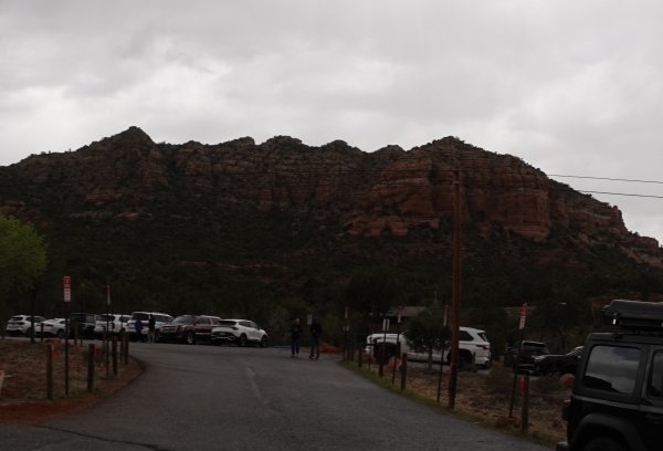
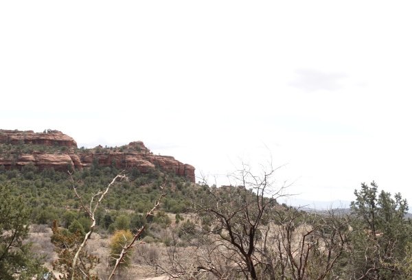
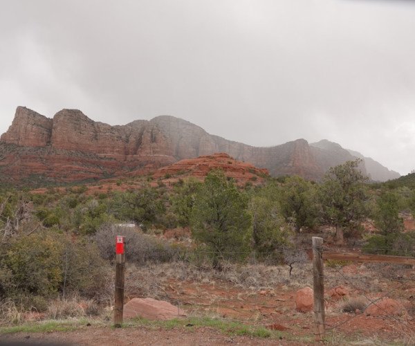
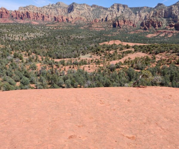
Red Rock State Park is a state park of Arizona, United States, featuring a red sandstone canyon outside the city of Sedona. The main mission of this day-use park is the preservation of the riparian habitat along Oak Creek. Red Rock State Park serves as an environmental education facility for the public and for school or private groups, and provides limited passive recreational opportunities.
46 Photos
Montezuma Castle National Monument protects a set of well-preserved dwellings located in Camp Verde, Arizona, which were built and used by the Sinagua people, a pre-Columbian culture closely related to the Hohokam and other indigenous peoples of the southwestern United States,[4] between approximately AD 1100 and 1425. The main structure comprises five stories and about 20 rooms and was built over the course of three centuries.[5] Several Hopi clans and Yavapai communities trace their ancestries to early immigrants from the Montezuma Castle/Beaver Creek area. Archaeological evidence proves that the Hohokam and Hakataya settled around or in the Verde Valley.Clan members periodically return to these ancestral homes for religious ceremonies.
47 Photos
Adobe Jack starts with compacted dirt on a smooth trail, compared to the much rockier trails in most of Sedona. The trail winds around on the natural contours and dips in and out of small washes and forest. As you get lower, it gets a little rougher and rockier. It lacks the grand vistas of other trails in Sedona, but it's still a super-fun hike.
22 Photos
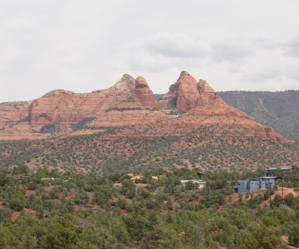
The Palatki Heritage Site is an archaeological site and park located in the Coconino National Forest, near Sedona, in Arizona, United States at approximately 34°54′56″N 111°54′08″W. In the Hopi language Palatki means 'red house'. Cliff dwellings The Palatki site has a set of ancient cliff dwellings in the red sandstone cliffs, built from 1100 to 1400 CE by the Sinagua people of the Ancestral Puebloans. The cliff dwellings were built under south-facing overhangs for shelter and winter sun. The Sinagua people planted crops and made pottery in the area.[1] Palatki and Honanki, another nearby archaeological site, had the largest cliff dwellings in the Red Rock formation area from 1150 to 1300 CE.[2] Palatki consists of two separate pueblos, suggesting two family or kin groups may have lived here, one in each pueblo. The circular shield-like pictographs above the eastern pueblo have been interpreted by some archaeologists as being a kin or clan symbol.[3] Rock art There are pictographs and petroglyphs at the Palatki site, including some that predate the cliff dwellings. Many of the pictographs on the rock walls are from the Sinagua. However, those created by peoples of the Archaic period in North America include some of the more abstract pictograph symbols and drawings that are 3,000 to 6,000 years old, and some of the petroglyphs, estimated to be 5,000 to 6,000 years old.[1] Archaeology Visitation to the site for over a century has caused degradation of the archaeological elements. It was begun by 19th century Euro-American settlers, with little archaeological awareness for the area. Photographs from the early 1900s show that an estimated 70 to 90 percent of the original structures have disappeared since then.
84 Photos
Three Rivers is an unincorporated community and census-designated place (CDP) in Tulare County, California, United States. Located in the foothills of the Sierra Nevada at the edge of the San Joaquin Valley, the town is near the entrance to the national parks of Sequoia and Kings Canyon. The town's name comes from its location near the junction of the North, Middle, and South Forks of the Kaweah River.
24 Photos
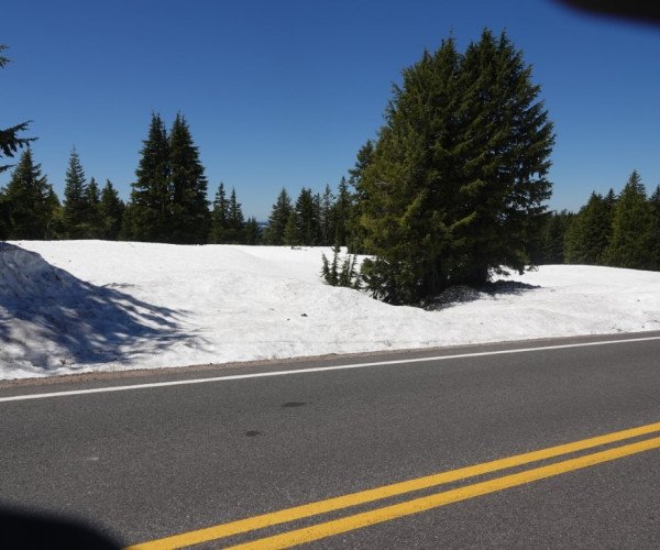
Crater Lake (Klamath: Giiwas) is a volcanic crater lake in south-central Oregon in the Western United States. It is the main feature of Crater Lake National Park and is a tourist attraction for its deep blue color and water clarity. The lake partly fills a 2,148-foot-deep (655 m) caldera that was formed around 7,700 (± 150) years ago[4] by the collapse of the volcano Mount Mazama. No rivers flow into or out of the lake; the evaporation is compensated for by rain and snowfall at a rate such that the total amount of water is replaced every 150 years. With a depth of 1,949 feet (594 m), the lake is the deepest in the United States. In the world, it ranks eleventh for maximum depth, as well as fifth for mean depth. Crater Lake features two small islands. Wizard Island, located near the western shore of the lake, is a cinder cone about 316 acres (128 hectares) in size. Phantom Ship, a natural rock pillar, is located near the southern shore.
111 Photos
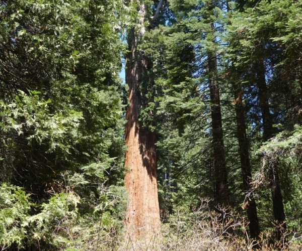
Kings Canyon National Park is a national park of the United States in the southern Sierra Nevada, in Fresno and Tulare Counties, California. Originally established in 1890 as General Grant National Park, the park was greatly expanded and renamed on March 4, 1940. The park's namesake, Kings Canyon, is a rugged glacier-carved valley more than a mile (1,600 m) deep. Other natural features include multiple 14,000-foot (4,300 m) peaks, high mountain meadows, swift-flowing rivers, and some of the world's largest stands of giant sequoia trees. Kings Canyon is north of and contiguous with Sequoia National Park, and both parks are jointly administered by the National Park Service as the Sequoia and Kings Canyon National Parks. The majority of the 461,901-acre (186,925 ha) park, drained by the Middle and South Forks of the Kings River and many smaller streams, is designated wilderness. Tourist facilities are concentrated in two areas: Grant Grove, home to General Grant (the second largest tree in the world, measured by trunk volume) and Cedar Grove, located in the heart of Kings Canyon. Overnight hiking is required to access most of the park's backcountry, or high country, which for much of the year is covered in deep snow. The combined Pacific Crest Trail/John Muir Trail, a backpacking route, traverses the entire length of the park from north to south.
107 Photos
Lake Tahoe (/ˈtɑːhoʊ/; Washo: dáʔaw) is a freshwater lake in the Sierra Nevada of the Western United States, straddling the border between California and Nevada. Lying at 6,225 ft (1,897 m) above sea level, Lake Tahoe is the largest alpine lake in North America, and at 122,160,280 acre⋅ft (150.7 km3) it trails only the five Great Lakes as the largest by volume in the United States. Its depth is 1,645 ft (501 m), making it the second deepest in the United States after Crater Lake in Oregon (1,949 ft or 594 m). The lake was formed about two million years ago as part of the Lake Tahoe Basin, and its modern extent was shaped during the ice ages. It is known for the clarity of its water and the panorama of surrounding mountains on all sides. The area surrounding the lake is also referred to as Lake Tahoe, or simply Tahoe; its English name is derived from its Washo name, Dáʔaw. More than 75% of the lake's watershed is national forest land, covered by the Lake Tahoe Basin Management Unit of the United States Forest Service.
44 Photos
Lassen Volcanic National Park is a national park of the United States in northeastern California. The dominant feature of the park is Lassen Peak, the largest plug dome volcano in the world and the southernmost volcano in the Cascade Range. Lassen Volcanic National Park is one of the few areas in the world where all four types of volcanoes can be found: plug dome, shield, cinder cone, and stratovolcano. The source of heat for the volcanism in the Lassen area is subduction of the Gorda plate diving below the North American plate off the Northern California coast. The area surrounding Lassen Peak is still active with boiling mud pots, fumaroles, and hot springs. Lassen Volcanic National Park started as two separate national monuments designated by President Theodore Roosevelt in 1907: Cinder Cone National Monument and Lassen Peak National Monument. Starting in May 1914 and lasting until 1917, a series of minor to major eruptions occurred on Lassen. Because of the eruptive activity and the area's stark volcanic beauty, Lassen Peak, Cinder Cone, and the area surrounding were established as a National Park on August 9, 1916.[
121 Photos
Montezuma Castle National Monument protects a set of well-preserved dwellings located in Camp Verde, Arizona, which were built and used by the Sinagua people, a pre-Columbian culture closely related to the Hohokam and other indigenous peoples of the southwestern United States, between approximately AD 1100 and 1425. The main structure comprises five stories and about 20 rooms and was built over the course of three centuries. Several Hopi clans and Yavapai communities trace their ancestries to early immigrants from the Montezuma Castle/Beaver Creek area. Archaeological evidence proves that the Hohokam and Hakataya settled around or in the Verde Valley. Clan members periodically return to these ancestral homes for religious ceremonies. Tuzigoot National Monument (Yavapai: ʼHaktlakva, Western Apache: Tú Digiz) preserves a 2- to 3-story pueblo ruin on the summit of a limestone and sandstone ridge just east of Clarkdale, Arizona, 120 feet (37 m) above the Verde River floodplain. The Tuzigoot Site is an elongated complex of stone masonry rooms that were built along the spine of a natural outcrop in the Verde Valley. The central rooms stand higher than the others and they appear to have served public functions. The pueblo has 110 rooms. The National Park Service currently administers 58 acres (23 hectares), within an authorized boundary of 834 acres (338 hectares). ″Tú Digiz/Tuzigoot″ is a Tonto Apache term for "crooked waters," from nearby Pecks Lake, a cutoff meander of the Verde River; from Tú Digiz one principal Tonto Apache clan gets its name. The pueblo was built by the Sinagua people between 1125 and 1400 CE. Tuzigoot is the largest and best preserved of the many Sinagua pueblo ruins in the Verde Valley. The ruins at Tuzigoot incorporate very few doors; instead, the inhabitants used ladders accessed by trapdoor type openings in the roofs to enter each room.
18 Photos

The Palatki site has a set of ancient cliff dwellings in the red sandstone cliffs, built from 1100 to 1400 CE by the Sinagua people of the Ancestral Puebloans. The cliff dwellings were built under south-facing overhangs for shelter and winter sun. The Sinagua people planted crops and made pottery in the area. Palatki and Honanki, another nearby archaeological site, had the largest cliff dwellings in the Red Rock formation area from 1150 to 1300 CE. Palatki consists of two separate pueblos, suggesting two family or kin groups may have lived here, one in each pueblo. The circular shield-like pictographs above the eastern pueblo have been interpreted by some archaeologists as being a kin or clan symbol.
47 Photos
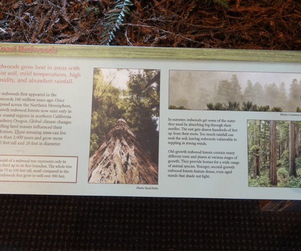
The Redwood National and State Parks (RNSP) are a complex of one United States national park and three California state parks located along the coast of northern California. The combined RNSP contain Redwood National Park, Del Norte Coast Redwoods State Park, Jedediah Smith Redwoods State Park, and Prairie Creek Redwoods State Park. The parks' 139,000 acres (560 km2) preserve 45 percent of all remaining old-growth coast redwood forests. Located in Del Norte and Humboldt counties, the four parks protect the endangered coast redwood (Sequoia sempervirens)—the tallest, among the oldest, and one of the most massive tree species on Earth—which thrives in the humid temperate rainforest. The park region is highly seismically active and prone to tsunamis. The parks preserve 37 miles (60 km) of pristine coastline, indigenous flora, fauna, grassland prairie, cultural resources, waterways, as well as threatened animal species, such as the Chinook salmon, northern spotted owl, and Steller's sea lion.
63 Photos
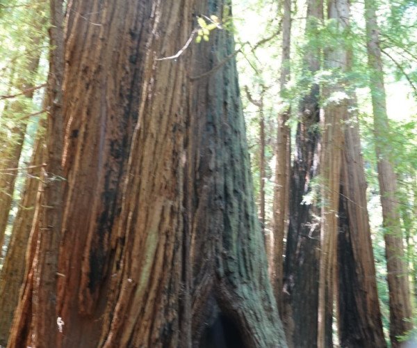
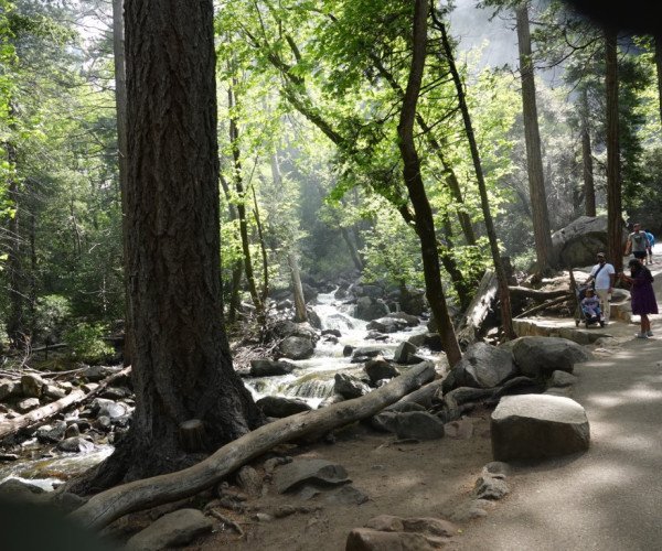
Only a few miles north of San Francisco, in a isolated canyon, grows the ancient coast redwood forest known the world over as Muir Woods. The park offers solitude, interpretive displays and programs, and numerous hiking trails. Come troll through 1,000 year old giant trees towering 260 feet high and find out why famed naturalist John Muir called this… “…the best tree-lovers monument that could possibly be found in all the forests of the world.”
73 Photos
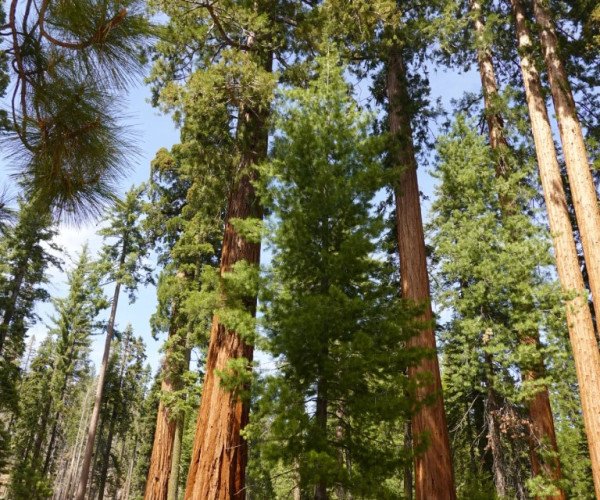
Sequoia National Park is a national park of the United States in the southern Sierra Nevada east of Visalia, California. The park was established on September 25, 1890, and today protects 404,064 acres (631 sq mi; 163,519 ha; 1,635 km2) of forested mountainous terrain. Encompassing a vertical relief of nearly 13,000 feet (4,000 m), the park contains the highest point in the contiguous United States, Mount Whitney, at 14,505 feet (4,421 m) above sea level.[4] The park is south of, and contiguous with, Kings Canyon National Park; both parks are administered by the National Park Service together as Sequoia and Kings Canyon National Parks. UNESCO designated the areas as Sequoia-Kings Canyon Biosphere Reserve in 1976. The park is notable for its giant sequoia trees, including the General Sherman Tree, the largest tree on Earth by volume. The General Sherman Tree grows in the Giant Forest, which contains five of the ten largest trees in the world. The Giant Forest is connected by the Generals Highway to Kings Canyon National Park's General Grant Grove, home of the General Grant tree among other giant sequoias. The park's giant sequoia forests are part of 202,430 acres (316 sq mi; 81,921 ha; 819 km2) of old-growth forests shared by Sequoia and Kings Canyon National Parks. The parks preserve a landscape that was first cultivated by the Monache tribe, the southern Sierra Nevada before Euro-American settlement
30 Photos
Yosemite National Park (/joʊˈsɛmɪti/ yoh-SEM-ih-tee[5]) is a national park of the United States in California. It is bordered on the southeast by Sierra National Forest and on the northwest by Stanislaus National Forest. The park is managed by the National Park Service and covers 1,187 sq mi (3,070 km2) in four counties – centered in Tuolumne and Mariposa, extending north and east to Mono and south to Madera. Designated a World Heritage Site in 1984, Yosemite is internationally recognized for its granite cliffs, waterfalls, clear streams, groves of giant sequoia, lakes, mountains, meadows, glaciers, and biological diversity. Almost 95 percent of the park is designated wilderness. Yosemite is one of the largest and least fragmented habitat blocks in the Sierra Nevada mountain range.
78 Photos
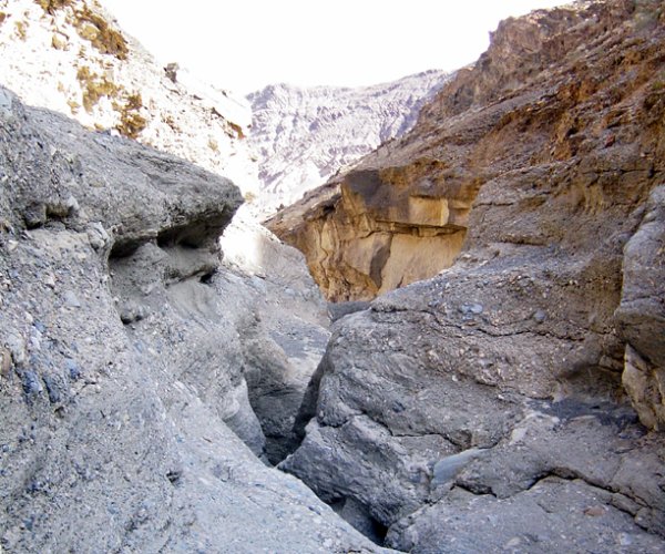
Death Valley National Park is a national park of the United States that straddles the California–Nevada border, east of the Sierra Nevada. The park boundaries include Death Valley, the northern section of Panamint Valley, the southern section of Eureka Valley and most of Saline Valley. The park occupies an interface zone between the arid Great Basin and Mojave deserts, protecting the northwest corner of the Mojave Desert and its diverse environment of salt-flats, sand dunes, badlands, valleys, canyons and mountains. Death Valley is the largest national park in the contiguous United States, as well as the hottest, driest and lowest of all the national parks in the United States. It contains Badwater Basin, the second-lowest point in the Western Hemisphere and lowest in North America at 282 feet (86 m) below sea level. More than 93% of the park is a designated wilderness area
116 Photos
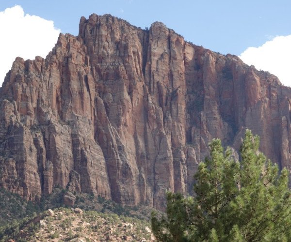
Zion National Park is a national park of the United States located in southwestern Utah near the town of Springdale. Located at the junction of the Colorado Plateau, Great Basin, and Mojave Desert regions, the park has a unique geography and a variety of life zones that allow for unusual plant and animal diversity. Numerous plant species as well as 289 species of birds, 75 mammals (including 19 species of bat), and 32 reptiles inhabit the park's four life zones: desert, riparian, woodland, and coniferous forest. Zion National Park includes mountains, canyons, buttes, mesas, monoliths, rivers, slot canyons, and natural arches. The lowest point in the park is 3,666 ft (1,117 m) at Coalpits Wash and the highest peak is 8,726 ft (2,660 m) at Horse Ranch Mountain. A prominent feature of the 229-square-mile (590 km2) park is Zion Canyon, which is 15 miles (24 km) long and up to 2,640 ft (800 m) deep. The canyon walls are reddish and tan-colored Navajo Sandstone eroded by the North Fork of the Virgin River. The park attracted 5 million visitors in 2023.
139 Photos